Skip to main content
Advanced Search
Using the Digital Collections
Browse by...
Keywords
Subjects
Explore All Items
Collection Item Sets
Finding Aids
Request Digitization
Request Holds
Browse
Browse
Browse item sets
Jones Memorial Library Map Collection
Title
Jones Memorial Library Map Collection
Description
Maps held at Jones Memorial Library in Lynchburg, Virgina
Identifier
Map
Items
Created
Resource class
Title
Date (numeric:interval)
Date (numeric:timestamp)
Temporal Coverage (numeric:interval)
Ascending
Descending
Sort
Advanced search
Northern part of Florida; 1864
Scale: 1" = 10 miles
Northern section of Roanoke County; 1864
Scale: 1/40,000
Official Map of City of Lynchburg; 1978
some of the annexations are tinted. Scale: 2 1/2" = 5000'
Original city and subsequent annexations, in the matter of City of Lynchburg vs Amherst County, Bedford County, Campbell County annexation proceedings; 1973
City Exhibit 24. Scale: 1" = 4000'
Part of Buckingham and Appomattox Counties, VA
Scale: 3" = 50,000'
Part of Buckingham and Appomattox Counties, VA
negative image. Scale: 3" = 50,000'
Peakland Plan A; 1911
Scale: 1" = 100'
Perkins Park No. 2: At auction Perkins Park No. 2 (the old Perkins home place) adjoinging Fairview Hghts [advertising broadside]; 1927
Scale: 1" = 200'
Plan A property of the Rivermont Company, Lynchburg, Va.; 1891
Scale: 1" - 200'
Plan B, Property of the Rivermont Company, Lynchburg, VA; 1891
Plan of final attack on Fort Fisher and adjoining rebel works; 1865; 1962
Scale: 4 3/8" = 1000 yds
Plan of Fort Huger, Hardy's Bluff; 1863
Scale: 30' = 1"
Plan of Fort Jackson, LA, showing the effect of the bombardment by the flotilla commanded by D. D. Porter between the 18th and 24th of April 1862
Scale: 50' = 1"
Plan of Lynchburg showing the new jail; 1829
Plan of Lynchburg-1827
Plan of Town of Lynchburg to be Recorded Sept 8, 1814
Position of 1st Division, 19th Army Corps at the battle near Sabine Cross Roads, Louisiana, April 8th, 1864; Battleground of Pleasant Hill and disposition of troops, April 9th, 1864
Position of gunboats at Grand Gulf, MS; 1863
Scale: 3 3/4" = 1000'
Position of iron clads, Fort Fisher , final attack on Fort Fisher; 1865
Preliminary map of a part of the south side of the James River; 1864
Scale: 1:160,000; 3 3/4" = 10 miles
Preliminary map of a part of the south side of the James River; 1864
Scale: 1:160,000; 3 3/4" = 10 miles
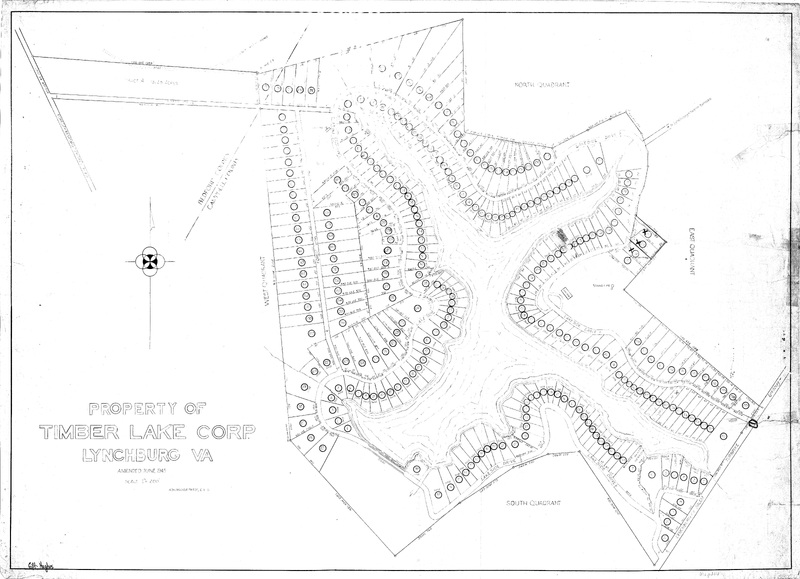
Property of Timber Lake Corp., Campbell County, VA; 1943
Digital image of a map of the Timber Lake Corporation development in Campbell County, Virginia. Scale: 1" = 200'
Quaker Burying Ground Collection; 1928
Includes: 1. large map; 2. Names from markers; 3/ Alphabetical list of names; 4. Map of vicinity of cemetery - labeled 1928; 5. Map of cemetery including trees and shrubs.
Reconnaissance of the Mississippi River, 1862
Scale: 1/10,000; 7 1/4" = 2 miles
Reconnaissance of Wilmington River and St. Augustine Creek from Wausau Sound to Savannah River, Georgia; 1864; 1962
Scale: 1/40,000; 1:2000
Showing 201 to 225 of 255 results
Page
of 11